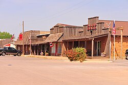
Freedom, Oklahoma | |
|---|---|
 | |
| Nickname: Queen City of the Cimarron | |
 Location of Freedom within Oklahoma | |
| Coordinates: 36°46′9″N 99°6′48″W / 36.76917°N 99.11333°W[1] | |
| Country | United States |
| State | Oklahoma |
| County | Woods |
| Incorporated | 1925 |
| Area | |
| • Total | 0.39 sq mi (1.01 km2) |
| • Land | 0.39 sq mi (1.01 km2) |
| • Water | 0.00 sq mi (0.00 km2) |
| Elevation | 1,529 ft (466 m) |
| Population (2020) | |
| • Total | 174 |
| • Density | 445.01/sq mi (171.96/km2) |
| Time zone | UTC-6 (CST) |
| • Summer (DST) | UTC-5 (CDT) |
| ZIP code | 73842 |
| Area code | 580 |
| FIPS code | 40-27850 [1] |
| GNIS feature ID | 1093038 [1] |
| Website | freedomokla.com |
Freedom is a town in Woods County, Oklahoma, United States.[1] It lies twenty-five miles west of Alva, on the banks of the Cimarron River.[3] The population was 174 at the time of the 2020 Census.[4]
- ^ a b c d e Geographic Names Information System (GNIS) details for Freedom, Oklahoma; United States Geological Survey (USGS); December 18, 1979.
- ^ "ArcGIS REST Services Directory". United States Census Bureau. Retrieved September 20, 2022.
- ^ Official State Map (Map) (2008 ed.). Oklahoma Department of Transportation.
- ^ "Freedom (town), Oklahoma". United States Census Bureau. Retrieved April 20, 2024.