This article needs additional citations for verification. (December 2009) |
| French Prealps | |
|---|---|
| Prealps | |
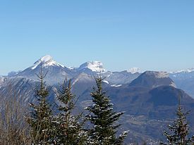
 Summits in the Chartreuse Mountains, part of the French Prealps | |
| Highest point | |
| Peak | Haute Cime |
| Elevation | 10,686 ft (3,257 m) |
| Geography | |
| Country | France |
| Regions | |
| Range coordinates | 43°59′N 6°6.65′E / 43.983°N 6.11083°E |
| Parent range | Alps |
| Geology | |
| Orogeny | Alpine orogeny |
| Rock ages | |
| Rock types | |
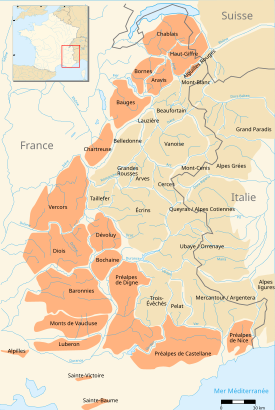
The French Prealps (French: Préalpes françaises [pʁealp fʁɑ̃sɛːz])[1] are a group of subalpine mountain ranges of medium elevation located immediately west of the French Alps. They roughly stretch from Lake Geneva southwest to the rivers Isère and Drôme; east to a line running from Chamonix, to Albertville, to Grenoble, to Gap, to Barcelonette; and south from Grasse to Vence.
In the northern subalpine regions, the various ranges are easily identifiable by geographical separations, such as the Voreppe Gorge between Vercors and Chartreuse, or Chambéry, which sits in a valley between the Bauges and Chartreuse ranges. In the southern subalpine regions, the ranges are generally disorganized and lack the wide, deep valleys that divide them in the north.
Three non-contiguous ranges traditionally comprise the southern French Prealps: the Alpilles, Mont Sainte-Victoire and Sainte-Baume.
