Frenchtown, Ohio | |
|---|---|
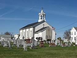
 Holy Family Church and Cemetery | |
 Location of Frenchtown, Ohio | |
| Coordinates: 40°14′47″N 84°31′26″W / 40.24639°N 84.52389°W | |
| Country | United States |
| State | Ohio |
| County | Darke |
| Township | Wayne |
| Elevation | 1,027 ft (313 m) |
| Time zone | UTC-5 (Eastern (EST)) |
| • Summer (DST) | UTC-4 (EDT) |
| GNIS feature ID | 1048761[1] |
Frenchtown is an unincorporated community in Wayne Township, Darke County, Ohio, United States. The community lies at the intersection of State Route 185 with Burns and Mangen Roads, approximately 2 miles (3.2 km) northwest of the village of Versailles.[2]
- ^ a b U.S. Geological Survey Geographic Names Information System: Frenchtown, Darke County, Ohio
- ^ DeLorme, Ohio Atlas & Gazetteer, 7th ed., Yarmouth: DeLorme, 2004, p. 54. ISBN 0-89933-281-1