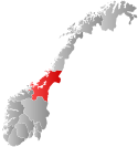
Frosta Municipality
Frosta kommune | |
|---|---|
| Frosten herred (historic name) | |
 Frosta seen from Hellan looking towards Trondheim | |
|
| |
 Trøndelag within Norway | |
 Frosta within Trøndelag | |
| Coordinates: 63°36′14″N 10°46′28″E / 63.60389°N 10.77444°E | |
| Country | Norway |
| County | Trøndelag |
| Established | 1 Jan 1838 |
| Administrative centre | Frosta |
| Government | |
| • Mayor (2019) | Frode Revhaug (H) |
| Area | |
| • Total | 76.33 km2 (29.47 sq mi) |
| • Land | 74.28 km2 (28.68 sq mi) |
| • Water | 2.04 km2 (0.79 sq mi) 2.7% |
| • Rank | #337 in Norway |
| Population (2023) | |
| • Total | 2,645 |
| • Rank | #245 in Norway |
| • Density | 35.6/km2 (92/sq mi) |
| • Change (10 years) | |
| Demonym | Frosting[1] |
| Official language | |
| • Norwegian form | Neutral |
| Time zone | UTC+01:00 (CET) |
| • Summer (DST) | UTC+02:00 (CEST) |
| ISO 3166 code | NO-5036[3] |
| Website | Official website |
Frosta is the smallest municipality in Trøndelag county, Norway. The administrative centre is the village of Frosta. The municipality is located along the Trondheimsfjord, on the Frosta peninsula, just north of the city of Trondheim. It also includes the island of Tautra which is connected to the mainland by a causeway bridge.
The 76-square-kilometre (29 sq mi) municipality is the 337th largest by area out of the 356 municipalities in Norway. Frosta is the 245th most populous municipality in Norway with a population of 2,645. The municipality's population density is 35.6 inhabitants per square kilometre (92/sq mi) and its population has increased by 0.7% over the previous 10-year period.[4][5]
- ^ "Navn på steder og personer: Innbyggjarnamn" (in Norwegian). Språkrådet.
- ^ "Forskrift om målvedtak i kommunar og fylkeskommunar" (in Norwegian). Lovdata.no.
- ^ Bolstad, Erik; Thorsnæs, Geir, eds. (26 January 2023). "Kommunenummer". Store norske leksikon (in Norwegian). Kunnskapsforlaget.
- ^ Statistisk sentralbyrå. "Table: 06913: Population 1 January and population changes during the calendar year (M)" (in Norwegian).
- ^ Statistisk sentralbyrå. "09280: Area of land and fresh water (km²) (M)" (in Norwegian).

