Fusa Municipality
Fusa kommune | |
|---|---|
| Fuse herred (historic name) | |
 View of the Sævareidfjorden | |
|
| |
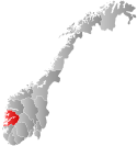
 Hordaland within Norway | |
 Fusa within Hordaland | |
| Coordinates: 60°14′50″N 05°48′26″E / 60.24722°N 5.80722°E | |
| Country | Norway |
| County | Hordaland |
| District | Midhordland |
| Established | 1856 |
| • Preceded by | Os Municipality |
| Disestablished | 1 Jan 2020 |
| • Succeeded by | Bjørnafjorden Municipality |
| Administrative centre | Eikelandsosen |
| Government | |
| • Mayor (2009-2019) | Atle Kvåle (Ap) |
| Area (upon dissolution) | |
| • Total | 377.84 km2 (145.88 sq mi) |
| • Land | 353.71 km2 (136.57 sq mi) |
| • Water | 24.13 km2 (9.32 sq mi) 6.4% |
| • Rank | #247 in Norway |
| Population (2019) | |
| • Total | 3,895 |
| • Rank | #234 in Norway |
| • Density | 11.0/km2 (28/sq mi) |
| • Change (10 years) | |
| Demonym | Fusing[1] |
| Official language | |
| • Norwegian form | Nynorsk |
| Time zone | UTC+01:00 (CET) |
| • Summer (DST) | UTC+02:00 (CEST) |
| ISO 3166 code | NO-1241[3] |
Fusa (Urban East Norwegian: [ˈfʉ̂ːsɑ]) is a former municipality in the old Hordaland county, Norway. It existed from 1856 until its dissolution in 2020. It was located east of the city of Bergen in the Midhordland region. The administrative centre of the municipality was the village of Eikelandsosen. Other villages in the municipality include Fusa, Holdhus, Holmefjord, Vinnes, Strandvik, and Sundvord. The Frank Mohn company's Fusa marine division is headquartered here, with almost 500 employees. On 1 January 2020, the municipality became part of the new Bjørnafjorden Municipality in Vestland county.
Prior to its dissolution in 2020, the 378-square-kilometre (146 sq mi) municipality was the 247th largest by area out of the 422 municipalities in Norway. Fusa was the 234th most populous municipality in Norway with a population of 3,895. The municipality's population density is 11 inhabitants per square kilometre (28/sq mi) and its population has increased by 3.9% over the last decade.[4]
- ^ "Navn på steder og personer: Innbyggjarnamn" (in Norwegian). Språkrådet.
- ^ "Forskrift om målvedtak i kommunar og fylkeskommunar" (in Norwegian). Lovdata.no.
- ^ Bolstad, Erik; Thorsnæs, Geir, eds. (26 January 2023). "Kommunenummer". Store norske leksikon (in Norwegian). Kunnskapsforlaget.
- ^ Statistisk sentralbyrå (2017). "Table: 06913: Population 1 January and population changes during the calendar year (M)" (in Norwegian). Retrieved 26 October 2017.

