Gaborone | |
|---|---|
|
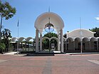
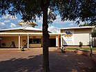
Top: Gaborone CBD; Middle: Botswana Parliament, Sir Seretse Khama International Airport; Bottom: Gaborone National Museum, Gaborone Dam | |
| Nicknames: Gabs, GC, Gabz, G-City, Mageba, Moshate | |
| Coordinates: 24°39′29″S 25°54′44″E / 24.65806°S 25.91222°E | |
| Country | |
| District | South East |
| Sub-district | Gaborone |
| Founded | 1964[1] |
| Named for | Kgosi Gaborone |
| Government | |
| • Type | City commission government |
| • Body | Gaborone City Council |
| • Mayor | Austin Abraham (BDP) |
| • Deputy Mayor | Oduetse Tautona (BDP) |
| Area | |
| • Capital city | 169 km2 (65.25 sq mi) |
| Elevation | 1,014 m (3,326 ft) |
| Population (2022)[4] | |
| • Capital city | 246,325 |
| • Density | 1,500/km2 (3,800/sq mi) |
| • Metro | 534,842 |
| Time zone | UTC+02:00 (Central Africa Time) |
| • Summer (DST) | (Not Observed) |
| Geographical area code[5][6] | 3XX |
| ISO 3166 code | BW-SE |
| HDI (2019) | 0.820[7] very high |
| Website | Gaborone City Council Website |
Gaborone (UK: /ˌɡæbəˈroʊni, ˌhæb-/ GAB-ə-ROH-nee, HAB-,[8][9] US: /ˌɡɑːbəˈroʊni, -neɪ/ GAH-bə-ROH-nee, -nay,[8][10] Tswana: [χabʊˈrʊnɛ]) is the capital and largest city of Botswana with a population of 246,325 based on the 2022 census,[4] about 10% of the total population of Botswana.[11] Its agglomeration is home to 534,842 inhabitants at the 2022 census.[12]
Gaborone is situated between Kgale Hill and Oodi Hill, near the confluence of the Notwane River and Segoditshane River in the south-eastern corner of Botswana, 15 kilometres (9.3 mi) from the South African border.[13] The city is served by the Sir Seretse Khama International Airport. It is an administrative district in its own right, but is the capital of the surrounding South-East District.[14] Locals often refer to the city as GC or Motse-Mshate.[15]
The city of Gaborone is named after Chief Gaborone of the Tlokwa tribe, who once controlled land nearby.[16] Because it had no tribal affiliation and was close to fresh water, the city was planned to be the capital in the mid-1960s when the Bechuanaland Protectorate became an independent nation.[16] The centre of the city is a long strip of commercial businesses, called "Main Mall" with a semicircle-shaped area of government offices to its east. Gaborone was once one of the fastest-growing cities in the world, and this has created problems with housing and illegal settlements. The city has also dealt with conflicts spilling into the country from Zimbabwe and South Africa during the 1980s.
Gaborone is the political and economic capital of Botswana, home to its largest companies and the Botswana Stock Exchange. It is also serves as the headquarters of the Southern African Development Community (SADC).[17] The main spoken languages in the city include Setswana (Tswana), English, Kalanga, and Kgalagadi.
- ^ Parsons, Neil (19 August 1999). "Botswana History Page 7: Geography". Botswana History Pages. Gaborone, Botswana: University of Botswana History Department. Archived from the original on 7 October 2009. Retrieved 4 August 2009.
- ^ Cite error: The named reference
BSYBwas invoked but never defined (see the help page). - ^ "Gaborone, Botswana Page". Falling Rain Genomics, Inc. Archived from the original on 4 September 2011. Retrieved 27 July 2010.
- ^ a b "Statistics Botswana - Census 2022 - Population of cities, towns and villages" (PDF).
- ^ "Current Local Time in Gaborone, Botswana". www.timeanddate.com. Archived from the original on 9 February 2014. Retrieved 28 April 2018.
- ^ Botswana Telecommunications Authority (11 September 2009). Botswana (country code +267). International Telecommunication Union. Archived from the original (DOC) on 27 December 2009. Retrieved 27 December 2009.
- ^ "Sub-national HDI – Area Database – Global Data Lab". hdi.globaldatalab.org. Retrieved 13 September 2018.
- ^ a b "Gaborone". Collins English Dictionary. HarperCollins. Archived from the original on 26 July 2019. Retrieved 26 July 2019.
- ^ "Gaborone". Lexico UK English Dictionary. Oxford University Press. Archived from the original on 22 March 2020.
- ^ "Gaborone". The American Heritage Dictionary of the English Language (5th ed.). HarperCollins. Retrieved 26 July 2019.
- ^ Cite error: The named reference
demowas invoked but never defined (see the help page). - ^ "Botswana: Districts, Cities, Towns, Urban Villages & Agglomerations - Population Statistics, Maps, Charts, Weather and Web Information". www.citypopulation.de. Retrieved 4 October 2024.
- ^ Seth, Willie (2008). "Major urban centres". Botswana and Its People. Godfrey Mwakikagile. pp. 44–46. ISBN 978-0-9814258-7-0. Retrieved 4 August 2009.
- ^ Laws of Botswana Archived 23 July 2011 at the Wayback Machine, Ministry of Local Government Archived 18 July 2009 at the Wayback Machine
- ^ Cite error: The named reference
history1was invoked but never defined (see the help page). - ^ a b "Map - Gaborone - MAP[N]ALL.COM". 174.127.109.64. Retrieved 30 May 2020.
- ^ "Southern African Development Community :: About SADC". www.sadc.int. Archived from the original on 12 March 2018. Retrieved 28 April 2018.


