Gajary | |
|---|---|
Municipality | |
 Main street with the church | |
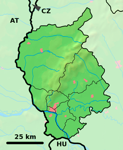
Location of Gajary in the Bratislava Region | |
| Coordinates: 48°27′58″N 16°55′26″E / 48.46611°N 16.92389°E | |
| Country | Slovakia |
| Region | Bratislava |
| District | Malacky |
| First mentioned | 1337 |
| Area | |
| • Total | 50.83[2] km2 (19.63[2] sq mi) |
| Elevation | 150[3] m (490[3] ft) |
| Population (2021) | |
| • Total | 3,145[1] |
| Postal code | 900 61[3] |
| Area code | +421 34[3] |
| Car plate | MA |
| Website | www.gajary.sk |
Gajary (German: Gayring; Hungarian: Gajar) is a village and municipality in western Slovakia close to the town of Malacky in the Bratislava region. It lies around 40 km (25 statute miles) north-west of Slovakia's capital Bratislava close to the Austrian border. The village has around 3500 inhabitants.
The village is an important archaeological site: findings from the Neolithic period, Eneolithic period, Bronze Age, early Slavic period (several Slavic settlements) have been excavated there.
- ^ "Počet obyvateľov podľa pohlavia - obce (ročne)". www.statistics.sk (in Slovak). Statistical Office of the Slovak Republic. 2022-03-31. Retrieved 2022-03-31.
- ^ a b "Hustota obyvateľstva - obce [om7014rr_ukaz: Rozloha (Štvorcový meter)]". www.statistics.sk (in Slovak). Statistical Office of the Slovak Republic. 2022-03-31. Retrieved 2022-03-31.
- ^ a b c d "Základná charakteristika". www.statistics.sk (in Slovak). Statistical Office of the Slovak Republic. 2015-04-17. Retrieved 2022-03-31.
- ^ a b "Hustota obyvateľstva - obce". www.statistics.sk (in Slovak). Statistical Office of the Slovak Republic. 2022-03-31. Retrieved 2022-03-31.

