Galbally
An Gallbhaile (Irish) | |
|---|---|
Village | |
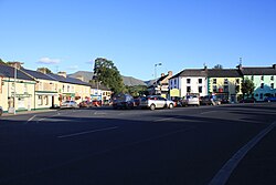
 View looking south from the village square | |
| Coordinates: 52°24′04″N 8°17′46″W / 52.401°N 8.296°W | |
| Country | Ireland |
| Province | Munster |
| County | County Limerick |
| Elevation | 112 m (367 ft) |
| Population | 269 |
| Irish Grid Reference | R798278 |
Galbally (Irish: An Gallbhaile, meaning 'town of the stranger or the foreigner')[2] is a village in southeast County Limerick, Ireland, on the border with County Tipperary. It is located at the foot of the Galtee Mountains and at the western approach to the Glen of Aherlow. The Aherlow River, flowing down from the Galtee mountains, runs by the village, to meet the Suir at Kilmoyler a short distance north of Cahir. Galbally is in a valley overlooked by the Galtee Mountains. The village is in a townland and civil parish of the same name.[2]
- ^ "Census Mapping - Towns: Galbally - Population Snapshot". visual.cso.ie. Central Statistics Office Ireland. 2022. Retrieved 16 June 2024.
- ^ a b "An Gallbhaile / Galbally". logainm.ie. Irish Placenames Commission. Retrieved 31 October 2018.
