Gallatin County | |
|---|---|
 Gallatin County Courthouse in Bozeman | |
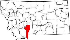
 Location within the U.S. state of Montana | |
 Montana's location within the U.S. | |
| Coordinates: 45°34′N 111°10′W / 45.56°N 111.17°W | |
| Country | |
| State | |
| Founded | 1865 |
| Named for | Gallatin River (Albert Gallatin) |
| Seat | Bozeman |
| Largest city | Bozeman |
| Area | |
• Total | 2,632 sq mi (6,820 km2) |
| • Land | 2,603 sq mi (6,740 km2) |
| • Water | 29 sq mi (80 km2) 1.1% |
| Population (2020) | |
• Total | 118,960 |
• Estimate (2022) | 124,938 |
| • Density | 45/sq mi (17/km2) |
| Time zone | UTC−7 (Mountain) |
| • Summer (DST) | UTC−6 (MDT) |
| Congressional district | 1st |
| Website | www |
| |
Gallatin County is a county located in the U.S. state of Montana. With its county seat in Bozeman, it is the second-most populous county in Montana, with a population of 118,960 in the 2020 Census.[1]
The county's prominent geographical features are the Bridger mountains in the north, and the Gallatin mountains and Gallatin River in the south, named by Meriwether Lewis in 1805 for Albert Gallatin,[2] the United States Treasury Secretary who formulated the Lewis and Clark Expedition.
At the southern end of the county, West Yellowstone's entrance into Yellowstone National Park accounts for around half of all park visitors. Big Sky Resort, one of the largest ski resorts in the United States, lies in Gallatin and neighboring Madison counties, midway between Bozeman and West Yellowstone.
- ^ "State & County QuickFacts". United States Census Bureau. Retrieved April 5, 2023.
- ^ Gannett, Henry (1905). The Origin of Certain Place Names in the United States. Govt. Print. Off. p. 133.
