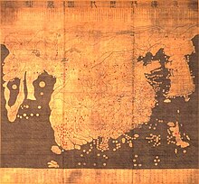
| Kangnido map (1402) | |
 | |
| Korean name | |
|---|---|
| Hangul | 혼일강리역대국도지도 |
| Hanja | 混一疆理歷代國都之圖 |
| Revised Romanization | Honil Gangni Yeokdae Gukdo Ji Do |
| McCune–Reischauer | Honil Kangni Yŏktae Kukto Chi To |
| Short name | |
| Hangul | 강리도 |
| Hanja | 疆理圖 |
| Revised Romanization | Gangnido |
| McCune–Reischauer | Kangnido |
The Honil Gangni Yeokdae Gukdo Ji Do ("Map of Integrated Lands and Regions of Historical Countries and Capitals (of China)"[1]), often abbreviated as Kangnido, is a world map completed by the Korean scholars Kwon Kun and Yi Hoe in 1402, during the Joseon dynasty.[2]
It is notably the oldest extant Korean world map,[1] with two known copies that are both currently located in Japan. It is also one of the oldest surviving world maps from East Asia, along with the Chinese Da Ming Hunyi Tu (ca. 1398), which the Kangido is theorized to share at least one source with.[3] Both were revised after their production, making their original form uncertain. Still, the surviving copies of the Kangnido can be used to infer the original content of the Chinese map.
As a world map, it reflects the geographic knowledge of China during the Mongol Empire when geographical information about Western countries became available via Islamic geographers.[4] It depicts the general form of the Old World, from Africa and Europe in the west to Japan in the east.[5] Although, overall, it is less geographically accurate than its Chinese cousin, notably in its depiction of rivers and small islands. It does feature some improvements (particularly the depictions of Korea, Japan, and Africa).
- ^ a b Kenneth R. Robinson Choson Korea in the Ryukoku Kangnido in Imago Mundi, Vol. 59 No. 2 (June 2007) pp. 177–192, via Ingenta Connect.
- ^ Cartography of Korea, pgs. 235–345, Gari Ledyard al., (Department of Geography, University of Wisconsin, Madison), The History of Cartography, Volume Two, Book Two, Cartography in Cartography in the Traditional East and Southeast Asian Societies, 1994, The University of Chicago Press, J. B. Harley and David Woodward ed., (Department of Geography, University of Wisconsin, Milwaukee, WI / Department of Geography, University of Wisconsin, Madison, WI), pgs. slip cover, 243–247, ISBN 0-226-31637-8.
- ^ 明代的古地图 (Ming Cartography), Cartography, GEOG1150, 2013, Qiming Zhou et. al., (Department of Geography, Hong Kong Baptist University), Hong Kong Baptist University, Kowloon, Hong Kong, China, retrieved 27 Jan 2013; "Cartography". Archived from the original on 2007-09-07. Retrieved 2008-03-16..
- ^ (Miya 2006; Miya 2007)
- ^ Angelo Cattaneo Europe on late Medieval and early Renaissance world maps, International BIMCC Conference (Nov 2007)