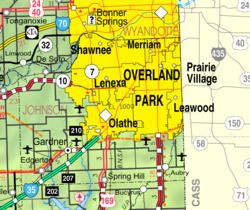
Gardner, Kansas | |
|---|---|
 Main & Elm Street (2022) | |
 Location within Johnson County and Kansas | |
 | |
| Coordinates: 38°48′41″N 94°55′41″W / 38.81139°N 94.92806°W[1] | |
| Country | United States |
| State | Kansas |
| County | Johnson |
| Founded | 1857 |
| Incorporated | 1887 |
| Named for | Henry Gardner |
| Government | |
| • Type | Mayor–Council |
| • Mayor | Todd Winters[2] |
| • City Administrator | Jim Pruetting |
| Area | |
| • Total | 10.31 sq mi (26.72 km2) |
| • Land | 10.28 sq mi (26.61 km2) |
| • Water | 0.04 sq mi (0.10 km2) |
| Elevation | 1,063 ft (324 m) |
| Population | |
| • Total | 23,287 |
| • Estimate (2021)[6] | 23,942 |
| • Density | 2,300/sq mi (870/km2) |
| Time zone | UTC-6 (CST) |
| • Summer (DST) | UTC-5 (CDT) |
| ZIP codes | 66030-66031 [7] |
| Area code | 913 |
| FIPS code | 20-25425 |
| GNIS ID | 485580[1] |
| Website | gardnerkansas.gov |
Gardner is a city in Johnson County, Kansas, United States.[1] As of the 2020 census, the population of the city was 23,287.[4][5] It is located within the Kansas City metropolitan area.
- ^ a b c d U.S. Geological Survey Geographic Names Information System: Gardner, Kansas
- ^ Cite error: The named reference
city-councilwas invoked but never defined (see the help page). - ^ "2019 U.S. Gazetteer Files". United States Census Bureau. Retrieved July 24, 2020.
- ^ a b "Profile of Gardner, Kansas in 2020". United States Census Bureau. Archived from the original on November 23, 2022. Retrieved November 22, 2022.
- ^ a b "QuickFacts; Gardner, Kansas; Population, Census, 2020 & 2010". United States Census Bureau. Archived from the original on August 24, 2021. Retrieved August 24, 2021.
- ^ Cite error: The named reference
USCensusEst2021was invoked but never defined (see the help page). - ^ United States Postal Service (2012). "USPS - Look Up a ZIP Code". Retrieved February 15, 2012.
