Gaular Municipality
Gaular kommune | |
|---|---|
| Indre Holmedal herred (historic name) | |
 View of the Brekkefossen waterfall | |
|
| |
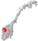
 Sogn og Fjordane within Norway | |
 Gaular within Sogn og Fjordane | |
| Coordinates: 61°20′02″N 05°47′20″E / 61.33389°N 5.78889°E | |
| Country | Norway |
| County | Sogn og Fjordane |
| District | Sunnfjord |
| Established | 1 Jan 1838 |
| • Created as | Formannskapsdistrikt |
| Disestablished | 1 Jan 2020 |
| • Succeeded by | Sunnfjord Municipality |
| Administrative centre | Sande |
| Government | |
| • Mayor (2011-2019) | Mathias Råheim (H) |
| Area (upon dissolution) | |
| • Total | 581.82 km2 (224.64 sq mi) |
| • Land | 539.57 km2 (208.33 sq mi) |
| • Water | 42.25 km2 (16.31 sq mi) 7.3% |
| • Rank | #190 in Norway |
| Population (2019) | |
| • Total | 3,027 |
| • Rank | #263 in Norway |
| • Density | 5.5/km2 (14/sq mi) |
| • Change (10 years) | |
| Demonym | Gaulværing[1] |
| Official language | |
| • Norwegian form | Nynorsk |
| Time zone | UTC+01:00 (CET) |
| • Summer (DST) | UTC+02:00 (CEST) |
| ISO 3166 code | NO-1430[3] |
| Website | Official website |
Gaular is a former municipality in Sogn og Fjordane county, Norway. It was located in the traditional district of Sunnfjord. The administrative centre was the village of Sande. Other villages in the municipality included Bygstad, Hestad, and Vik. Gaular was sometimes referred to as Fosselandet (the land of the waterfalls) because it was home to 28 large and small waterfalls. The municipality was centered on the river Gaula. The Viksdalen valley was located in Gaular.
At the time of its dissolution in 2020, the 582-square-kilometre (225 sq mi) municipality is the 190th largest by area out of the 422 municipalities in Norway. Gaular is the 263rd most populous municipality in Norway with a population of 3,027. The municipality's population density is 5.7 inhabitants per square kilometre (15/sq mi) and its population has increased by 9.8% over the last decade.[4][5]
In 2016, the chief of police for Vestlandet formally suggested a reconfiguration of police districts and stations. He proposed that the police station in Gaular be closed.[6]
- ^ "Navn på steder og personer: Innbyggjarnamn" (in Norwegian). Språkrådet.
- ^ "Forskrift om målvedtak i kommunar og fylkeskommunar" (in Norwegian). Lovdata.no.
- ^ Bolstad, Erik; Thorsnæs, Geir, eds. (26 January 2023). "Kommunenummer". Store norske leksikon (in Norwegian). Kunnskapsforlaget.
- ^ Statistisk sentralbyrå (2018). "Table: 06913: Population 1 January and population changes during the calendar year (M)" (in Norwegian). Retrieved 11 November 2019.
- ^ Statistisk sentralbyrå. "09280: Area of land and fresh water (km²) (M)" (in Norwegian). Retrieved 11 November 2019.
- ^ Fjelltveit, Ingvild; Raunholm, Per Vidar (20 December 2016). "Foreslår å legge ned 17 lensmannskontor i Vest politidistrikt". NRK Hordaland (in Norwegian). Retrieved 20 October 2017.

