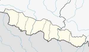
Gaur
गौर | |
|---|---|
| Nickname: Gaur Nagarpalika | |
| Motto(s): Clean Gaur, Green Gaur | |
| Coordinates: 26°46′N 85°16′E / 26.767°N 85.267°E | |
| Country | |
| Province | Province No. 2 |
| Zone | Narayani |
| District | Rautahat |
| Municipality establishment | 2049 B.S. (1992 CE) |
| Government | |
| • Mayor | Md Aasim from Narkatiya |
| • Deputy Mayor | Sakil Akhtar SA |
| Area | |
| • Total | 31.91 km2 (12.32 sq mi) |
| Elevation | 79 m (260 ft) |
| Population (2011) | |
| • Total | 34,937[1] |
| • Ethnic Groups | Kayastha Bhumihar Yadav Chhetri Brahman Marwari Maithili Tharu Koche Rajbanshi Rajput |
| • Religions | Hinduism Islam Kirant Buddhism |
| Time zone | UTC+5:45 (NST) |
| Postal code | 44500 |
| Area code | 055 |
| Geocode | NP-TW |
| Main language | Bhojpuri, Maithili, Nepali, Bajjika |
| Major highways | F07 Chandrapur - National Highway 227F Bairgania - Mehsi - Patna Expressway |
| Literacy Rate | |
| Website | gaurmun.gov.np |
Gaur is a municipality and headquarters of Rautahat district of Narayani zone, Nepal. It lies at the border of Nepal that links India via Bairgania and has a customs checkpoint.
The former Prime Minister of Nepal Madhav Kumar Nepal is a resident.[2]
- ^ Central Bureau Statistics: National Population and Housing Census 2018 (p. 54, nr 33). Archived July 31, 2013, at the Wayback Machine
- ^ The Economist, "Broken peaces", 29 March 2007

