Geisa | |
|---|---|
 | |
Location of Geisa within Wartburgkreis district  | |
| Coordinates: 50°43′N 09°58′E / 50.717°N 9.967°E | |
| Country | Germany |
| State | Thuringia |
| District | Wartburgkreis |
| Government | |
| • Mayor (2020–26) | Manuela Henkel[1] |
| Area | |
| • Total | 71.75 km2 (27.70 sq mi) |
| Elevation | 318 m (1,043 ft) |
| Population (2022-12-31)[2] | |
| • Total | 4,823 |
| • Density | 67/km2 (170/sq mi) |
| Time zone | UTC+01:00 (CET) |
| • Summer (DST) | UTC+02:00 (CEST) |
| Postal codes | 36419 |
| Dialling codes | 036967 |
| Vehicle registration | WAK |
| Website | www.geisa.de |
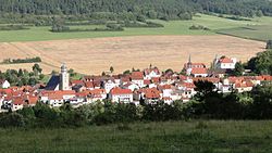
Geisa (German pronunciation: [ˈɡaɪ̯za] ) is a town in the Wartburgkreis district, in Thuringia, Germany. It is situated in the Rhön Mountains, 26 km northeast of Fulda. The near border with Hesse was the border between West Germany and the GDR during the Cold War. Thus, Geisa was in the East German border restriction area of the former inner German border, which meant that until reunification access to the town was limited. The town is the westernmost municipality in what was formerly East Germany.
- ^ Gewählte Bürgermeister - aktuelle Landesübersicht, Freistaat Thüringen, accessed 14 July 2021.
- ^ "Bevölkerung der Gemeinden, erfüllenden Gemeinden und Verwaltungsgemeinschaften in Thüringen Gebietsstand: 31.12.2022" (in German). Thüringer Landesamt für Statistik. June 2023.


