Gennep | |
|---|---|
 View over Gennep | |
 Location in Limburg | |
| Coordinates: 51°42′N 5°58′E / 51.700°N 5.967°E | |
| Country | Netherlands |
| Province | Limburg |
| Government | |
| • Body | Municipal council |
| • Mayor | Peter de Koning (VVD) |
| Area | |
| • Total | 50.42 km2 (19.47 sq mi) |
| • Land | 47.62 km2 (18.39 sq mi) |
| • Water | 2.80 km2 (1.08 sq mi) |
| Elevation | 13 m (43 ft) |
| Population (January 2021)[4] | |
| • Total | 17,035 |
| • Density | 358/km2 (930/sq mi) |
| Demonym(s) | Gennepenaar, Genneper |
| Time zone | UTC+1 (CET) |
| • Summer (DST) | UTC+2 (CEST) |
| Postcode | 6590–6599 |
| Area code | 0485 |
| Website | www |

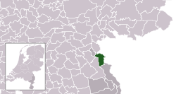
Gennep (Dutch pronunciation: [ˈɣɛnəp] ) is a municipality and a city in upper southeastern Netherlands. It lies in the very northern part of the province of Limburg, 18 km south of Nijmegen. Furthermore, it lies on the right bank of the Meuse river, and south of the forest of the Klever Reichswald. The municipality of Gennep has 17,277 inhabitants (2014).
The Niers river flows into the Meuse in Gennep.
- ^ "Burgemeester Dhr. P.J.H.M. De Koning" [Mayor Mr. P.J.H.M. De Koning] (in Dutch). Gemeente Gennep. Archived from the original on 17 October 2013. Retrieved 16 October 2013.
- ^ "Kerncijfers wijken en buurten 2020" [Key figures for neighbourhoods 2020]. StatLine (in Dutch). CBS. 24 July 2020. Retrieved 19 September 2020.
- ^ "Postcodetool for 6591CP". Actueel Hoogtebestand Nederland (in Dutch). Het Waterschapshuis. Archived from the original on 21 September 2013. Retrieved 16 October 2013.
- ^ "Bevolkingsontwikkeling; regio per maand" [Population growth; regions per month]. CBS Statline (in Dutch). CBS. 1 January 2021. Retrieved 2 January 2022.
