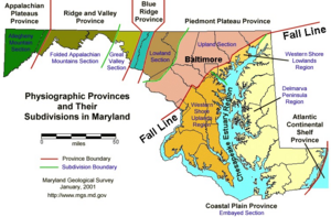
The U.S. state of Maryland has a varied geography. It has an area of 12,406.68 square miles (32,133.2 km2) and is comparable in overall area with Belgium [11,787 square miles (30,530 km2)].[1] It is the 42nd largest and 9th smallest state and is closest in size to the state of Hawaii (10,930.98 square miles (28,311.1 km2)), the next smallest state. The next largest state, its neighbor West Virginia, is almost twice the size of Maryland (24,229.76 square miles (62,754.8 km2)). Maryland borders Pennsylvania to the north, Delaware to the northeast, the Atlantic Ocean to the east, and to the west and south by West Virginia and Virginia.