 | |
| Continent | Africa |
|---|---|
| Region | East Africa |
| Coordinates | 18°15′S 35°00′E / 18.250°S 35.000°E |
| Area | Ranked 35th |
| • Total | 801,590 km2 (309,500 sq mi) |
| • Land | 98.37% |
| • Water | 1.63% |
| Coastline | 2,500 km (1,600 mi) |
| Borders | None |
| Highest point | Monte Binga 2,436 m (7,992 ft) |
| Lowest point | Indian Ocean 0 m (0 ft) |
| Exclusive economic zone | 578,986 km2 (223,548 sq mi) |


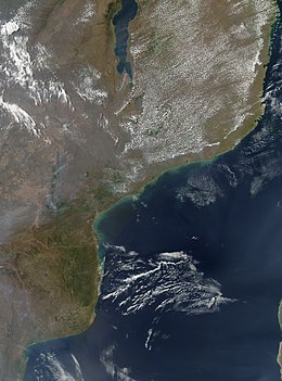
The geography of Mozambique consists mostly of coastal lowlands with uplands in its center and high plateaus in the northwest. There are also mountains in the western portion. The country is located on the east coast of southern Africa, directly west of the island of Madagascar. Mozambique has a tropical climate with two seasons, a wet season from October to March and a dry season from April to September.