 | |
| Continent | Australia |
|---|---|
| Coordinates | 32°S 147°E / 32°S 147°E |
| Area | Ranked 3rd among states and territories |
| • Total | 801,150 km2 (309,330 sq mi) |
| Coastline | 2,137 km (1,328 mi) |
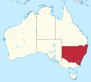
| Borders | Land borders: Queensland, South Australia, Victoria, Australian Capital Territory |
| Highest point | Mount Kosciuszko 2,228 metres (7,310 ft) |
| Longest river | Murray River 1,721 kilometres (1,069 mi) |
| Largest lake | Lake Eucumbene 4,798 square kilometres (1,853 sq mi) |
New South Wales (abbreviated as NSW) is Australia's most populous state, located in the east coast of the continent. It is in the southern hemisphere between latitudes 28 and 38 degrees south of the equator and longitudes 141 and 154 degrees east of the Universal Prime Meridian (formerly known as the Greenwich meridian). The state is in the warm temperate climatic zone.