Washington is the northwesternmost state of the contiguous United States. It borders Idaho to the east, bounded mostly by the meridian running north from the confluence of the Snake River and Clearwater River (about 117°02'23" west), except for the southernmost section where the border follows the Snake River. Oregon is to the south, with the Columbia River forming the western part and the 46th parallel forming the eastern part of the Oregon–Washington border. During Washington's partition from Oregon, the original plan for the border followed the Columbia River east until the confluence with the Snake, and then would have followed the Snake River east; this was changed to keep Walla Walla's fertile farmland in Washington.
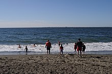
To the west of Washington lies the Pacific Ocean.[1] Its northern border lies mostly along the 49th parallel, and then via marine boundaries through the Strait of Georgia, Haro Strait, and Strait of Juan de Fuca, with the Canadian province of British Columbia to the north.[2]
- ^ "Washington State Constitution—Article XXIV—Boundaries". Washington State Legislature. Archived from the original on July 24, 2019. Retrieved April 17, 2014.
- ^ "Britain and the United States agree on the 49th parallel as the main Pacific Northwest boundary in the Treaty of Oregon on June 15, 1846—HistoryLink.org". Historylink.org. Archived from the original on September 13, 2017. Retrieved September 4, 2017.
