| George Washington and Jefferson National Forests | |
|---|---|
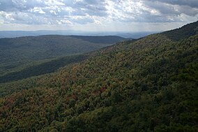
 White Rocks on Little Sluice Mountain in George Washington National Forest. | |
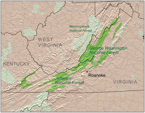
 Location of George Washington and Jefferson National Forests | |
| Location | United States |
| Coordinates | 38°30′0″N 79°0′0″W / 38.50000°N 79.00000°W |
| Area | 1,790,933 acres (7,247.65 km2) |
| Established | 1995[1] |
| Website | George Washington and Jefferson National Forests |

The George Washington and Jefferson National Forests is an administrative entity combining two U.S. National Forests into one of the largest areas of public land in the Eastern United States. The forests cover 1.8 million acres (2,800 sq mi) of land in the Appalachian Mountains of Virginia, West Virginia, and Kentucky. Approximately 1 million acres (1,600 sq mi) of the forest are remote and undeveloped and 139,461 acres (218 sq mi)[2] have been designated as wilderness areas, which prohibits future development.
- ^ Cite error: The named reference
GWJNF Forest Factswas invoked but never defined (see the help page). - ^ "Wilderness.net search page". Archived from the original on 2009-08-20. Retrieved 2009-09-21.