| Getar River | |
|---|---|
 | |
| Location | |
| Country | Armenia |
| Physical characteristics | |
| Source | |
| • location | Gegham mountains, Kotayk Province[1] |
| Mouth | Hrazdan |
• coordinates | 40°09′00″N 44°29′39″E / 40.1499°N 44.4941°E |
| Length | 24 km (15 mi) |
| Basin features | |
| Progression | Hrazdan→ Aras→ Kura→ Caspian Sea |
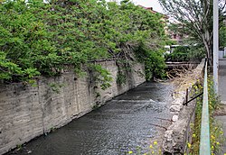
The Getar (Գետառ), formerly spelled Gedar,[2][3] is a small river in Armenia that flows through Kotayk Province and central parts of the capital Yerevan. It originates near the village of Mayakovski at the western parts of Gegham mountains, flows through Avan-Arinj and joins the Hrazdan at the outskirts of Yerevan. Its length is about 24 kilometres (15 mi).[4][5]
- ^ Kiesling, Brady; Kojian, Raffi (2001). Rediscovering Armenia: an archaeological/touristic gazetteer and map set for the historical monuments of Armenia. Yerevan: Tigran Mets. p. 35. ISBN 978-9993052289.
- ^ American Geographical Society of New York (1990). "Soviet geography". 31 (6–10). American Geographical Society: 578.
{{cite journal}}: Cite journal requires|journal=(help) - ^ M. I. L'vovich (1979). World water resources and their future. Chelsa, Michigan: American Geophysical Union. p. 229. ISBN 9780875902241.
- ^ Հայաստանի Հանրապետության Ֆիզիկաաշխարհագրական օբյեկտների համառոտ տեղեկատու-բառարան (Brief Dictionary of Physical Objects of the Republic of Armenia) (PDF) (in Armenian). Yerevan: State Committee of the Real Estate Cadastre. 2007. p. 30. Archived from the original (PDF) on 2018-05-17. Retrieved 2012-12-31.
- ^ Cite error: The named reference
banadzevwas invoked but never defined (see the help page).