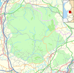
| Gisburn Forest | |
|---|---|
 Gisburn Forest in the parish of Gisburn Forest | |
Location within Lancashire | |
| Area | 17.9253 km2 (6.9210 sq mi) |
| Population | 151 (2011 census)[1] |
| • Density | 8/km2 (21/sq mi) |
| OS grid reference | SD770556 |
| Civil parish |
|
| District | |
| Shire county | |
| Region | |
| Country | England |
| Sovereign state | United Kingdom |
| Post town | SKIPTON |
| Postcode district | BD23 |
| Dialling code | 01729 |
| Police | Lancashire |
| Fire | Lancashire |
| Ambulance | North West |
| UK Parliament | |
Gisburn Forest is a civil parish in the Ribble Valley, in Lancashire, England. Mainly lying within the Forest of Bowland Area of Outstanding Natural Beauty, the parish includes the larger part of the village of Tosside and the hamlet of Grunsagill to the south. Historically, the parish lay within the West Riding of Yorkshire. It had a population of 151 at the 2011 Census.[1]
The parish adjoins the Ribble Valley parishes of Easington, Bolton-by-Bowland and Paythorne along with Lawkland, Giggleswick, Rathmell, Wigglesworth and Halton West in the Craven district of North Yorkshire.[a]
- ^ a b UK Census (2011). "Local Area Report – Gisburn Forest Parish (E04005259)". Nomis. Office for National Statistics. Retrieved 13 January 2022.
- ^ Cite error: The named reference
Mariowas invoked but never defined (see the help page).
Cite error: There are <ref group=lower-alpha> tags or {{efn}} templates on this page, but the references will not show without a {{reflist|group=lower-alpha}} template or {{notelist}} template (see the help page).


