| Gizhiga Гижига / Вуйвов’эем | |
|---|---|
 NASA image of the Gizhiga river basin | |
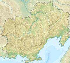
Mouth location in Magadan Oblast, Russia | |
| Location | |
| Country | Russia |
| Federal subject | Magadan Oblast |
| District | Severo-Evensky District |
| Physical characteristics | |
| Source | |
| • location | Korbendya Range Kolyma Mountains |
| • coordinates | 62°52′39″N 158°45′09″E / 62.87750°N 158.75250°E |
| • elevation | ca 1,000 m (3,300 ft) |
| Mouth | Sea of Okhotsk |
• location | Gizhiga Bay |
• coordinates | 61°58′07″N 160°24′29″E / 61.96861°N 160.40806°E |
• elevation | 0 m (0 ft) |
| Length | 221 km (137 mi) |
| Basin size | 11,900 km2 (4,600 sq mi) |
| Discharge | |
| • average | 151.8 m3/s (5,360 cu ft/s) |
The Gizhiga (Russian: Гижига; Koryak: Вуйвов’эем) is a river in Magadan Oblast, Russian Far East. It is 221 kilometres (137 mi) long, with a drainage basin of 11,900 square kilometres (4,600 sq mi).[1]
The name of the river probably originated in the Chukchi "Ḳtig" (Ӄитиг), meaning "frost" or "cold wind". In Koryak it is known as "Vuyvov'eyem" (Вуйвов’эем), meaning "fortress river".[2]
- ^ "Река Гижига in the State Water Register of Russia". textual.ru (in Russian).
- ^ Leontyev V.V. , Novikova K.A. Toponymic dictionary of the North-East of the USSR, USSR Academy of Sciences. Magadan, 1989 - p. 120 - ISBN 5-7581-0044-7
