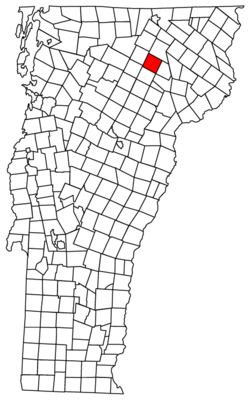
Glover, Vermont | |
|---|---|
Town | |
 Glover Hall | |
 Located in Orleans County, Vermont | |
 Location of Vermont with the U.S.A. | |
| Coordinates: 44°41′39″N 72°13′16″W / 44.69417°N 72.22111°W | |
| Country | United States |
| State | Vermont |
| County | Orleans |
| Chartered | November 20, 1783 |
| Named for | John Glover |
| Communities |
|
| Area | |
| • Total | 38.6 sq mi (100.0 km2) |
| • Land | 37.9 sq mi (98.1 km2) |
| • Water | 0.7 sq mi (1.9 km2) |
| Elevation | 945 ft (507 m) |
| Population (2020) | |
| • Total | 1,114 |
| • Density | 30/sq mi (11.4/km2) |
| • Households | 446 |
| • Families | 282 |
| Time zone | UTC-5 (EST) |
| • Summer (DST) | UTC-4 (EDT) |
| ZIP code | 05839 |
| Area code | 802 |
| FIPS code | 50-28075[1] |
| GNIS feature ID | 1462103[2] |
Glover is a town in Orleans County, Vermont, in the United States. As of the 2020 census,[3] the town's population was 1,114. It contains two unincorporated villages, Glover and West Glover.
The town is named for Brigadier General John Glover,[4] who served in the American Revolutionary War. He was the prime proprietor of the town.
Glover is home to three museums: the Bread & Puppet Museum, the Glover Historical Society museum, and The Museum of Everyday Life.[5]
- ^ "U.S. Census website". United States Census Bureau. Retrieved January 31, 2008.
- ^ "US Board on Geographic Names". United States Geological Survey. October 25, 2007. Retrieved January 31, 2008.
- ^ "Census - Geography Profile: Glover town, Orleans County, Vermont". Retrieved December 30, 2021.
- ^ Gannett, Henry (1905). The Origin of Certain Place Names in the United States. Govt. Print. Off. p. 139.
- ^ "Museum of Every Day Life". Retrieved September 27, 2020.