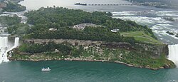
 Goat Island | |
| Geography | |
|---|---|
| Location | Niagara River |
| Coordinates | 43°04′51″N 79°04′03″W / 43.08083°N 79.06750°W |
| Highest elevation | 558 ft (170.1 m)[1] |
| Administration | |
United States | |
| State | New York |
| County | Niagara |
| City | Niagara Falls, New York |
| Additional information | |
| Official website | Official website |
Goat Island (previously called Iris Island) is a small island in the Niagara River, in the middle of Niagara Falls between the Bridal Veil Falls and the Horseshoe Falls. The island is at the southwest corner of the City of Niagara Falls (and of Niagara County), New York, in the United States and is part of Niagara Falls State Park.
Goat Island has no residents but is a destination for tourists visiting the falls on the U.S. side. It has several viewing points, including Terrapin Point. Goat Island is connected to the U.S. mainland by two bridges that carry foot, car, and trackless train traffic, and to the smaller Luna Island (adjacent to the American Falls) by a pedestrian bridge. Goat Island is largely wooded and is interlaced with foot trails. The Cave of the Winds tour elevator provides access down to the foot of the falls.
