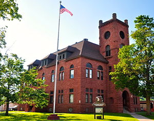
Gogebic County | |
|---|---|
 | |
 Location within the U.S. state of Michigan | |
 Michigan's location within the U.S. | |
| Coordinates: 46°29′N 89°47′W / 46.48°N 89.79°W | |
| Country | |
| State | |
| Founded | 1887[1] |
| Named for | Lake Gogebic |
| Seat | Bessemer |
| Largest city | Ironwood |
| Area | |
| • Total | 1,476 sq mi (3,820 km2) |
| • Land | 1,102 sq mi (2,850 km2) |
| • Water | 374 sq mi (970 km2) 25% |
| Population (2020) | |
| • Total | 14,380 |
| • Density | 15/sq mi (6/km2) |
| Time zone | UTC−6 (Central) |
| • Summer (DST) | UTC−5 (CDT) |
| Congressional district | 1st |
| Website | www |
Gogebic County (/ɡoʊˈɡiːbɪk/ goh-GHEE-bik or /ɡoʊˈɡɛbɪk/ goh-GHEH-bik) is a county in the Upper Peninsula of the U.S. state of Michigan. As of the 2020 census, the population was 14,380.[2] The county seat is Bessemer.[3] Gogebic County is the westernmost county in Michigan, and is one of four Michigan counties within the Central Time Zone. Gogebic County borders Wisconsin to the south, and has a shoreline on Lake Superior to the north.
Gogebic County has long been territory of the Lake Superior Chippewa. The Lac Vieux Desert Indian Reservation is located within Gogebic County.
- ^ "Bibliography on Gogebic County". Clarke Historical Library, Central Michigan University. Retrieved June 29, 2013.
- ^ "State & County QuickFacts". US Census Bureau. Retrieved September 15, 2021.
- ^ "Find a County". National Association of Counties. Archived from the original on May 31, 2011. Retrieved June 7, 2011.
