| Golfo San Jorge Basin | |
|---|---|
| Cuenca del Golfo San Jorge | |
Oil well near the port city of Comodoro Rivadavia | |
| Coordinates | 45°00′S 67°50′W / 45.000°S 67.833°W |
| Etymology | San Jorge Gulf |
| Location | Southern South America |
| Region | Patagonia |
| Country | |
| State(s) | Chubut, Santa Cruz |
| Cities | Comodoro Rivadavia |
| Characteristics | |
| On/Offshore | Both |
| Boundaries | North Patagonian Massif, Deseado Massif, Andes |
| Part of | Southern Atlantic rift basins |
| Area | 170,000 km2 (66,000 sq mi) |
| Hydrology | |
| Sea(s) | South Atlantic |
| River(s) | Chico River |
| Lake(s) | Lake Musters and Lake Colhué Huapí |
| Geology | |
| Basin type | Rift |
| Plate | South American |
| Orogeny | Opening of the South Atlantic |
| Age | Early Jurassic-Pleistocene |
| Stratigraphy | Stratigraphy |
| Field(s) | Cañadón León, Cerro Dragón, Diadema, El Tordillo |

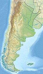
The Golfo San Jorge Basin (Spanish: Cuenca del Golfo San Jorge) is a hydrocarbon-rich sedimentary basin located in eastern Patagonia, Argentina. The basin covers the entire San Jorge Gulf and an inland area west of it, having one half located in Santa Cruz Province and the other in Chubut Province. The northern boundary of the basin is the North Patagonian Massif while the Deseado Massif forms the southern boundary of the basin. The basin has largely developed under condition of extensional tectonics, including rifting.[1]
The basin is of paleontological significance as it hosts six out of 22 defining formations for the SALMA classification, the geochronology for the Cenozoic used in South America.
At the center of the basin accumulated sediments reach more than 8,000 metres (26,000 ft) of thickness. Oil was first discovered in 1907 and over the years it has become the second most productive hydrocarbon basin in Argentina after Neuquén Basin.[1]
- ^ a b Sylwan, Caudio A. (2001). "Geology of the Golfo San Jorge Basin, Argentina". Journal of Iberian Geology. 27: 123–157. Retrieved 4 December 2015.
