Gongliao
貢寮區 Kōryō | |
|---|---|
| Gongliao District | |
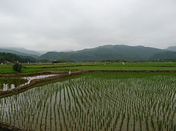
 Farmland and hills in Gongliao District | |
 Gongliao District in New Taipei City | |
| Coordinates: 25°1′N 121°54′E / 25.017°N 121.900°E | |
| Country | Republic of China (Taiwan) |
| Special municipality | New Taipei City |
| Area | |
| • Total | 38.60 sq mi (99.97 km2) |
| Population (March 2023) | |
| • Total | 11,177 |
| Time zone | +8 |
| Website | www |

Gongliao District (Chinese: 貢寮區; pinyin: Gòngliáo Qū; Pe̍h-ōe-jī: Kòng-liâu-khu; originally Chinese: 摃仔寮; Pe̍h-ōe-jī: Kòng-á-liâu[1]) is a rural district in the eastern part of New Taipei City, Taiwan.[2] It is the easternmost district on the main island of Taiwan and at its easternmost tip is Cape Santiago.
- ^ "關於貢寮-貢寮區公所". www.gongliao.ntpc.gov.tw.
- ^ "New Taipei City Government - Gongliao". Archived from the original on 2014-03-04. Retrieved 2014-02-21.