Paggank Noten Eylandt Nutten Island | |
|---|---|
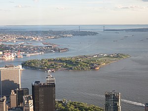
 Governors Island viewed from One World Trade Center in 2017 | |
 Location in New York City | |
| Etymology |
|
| Geography | |
| Location | New York Harbor |
| Coordinates | 40°41′29″N 74°0′58″W / 40.69139°N 74.01611°W |
| Area | 172 acres (70 ha) |
| Highest elevation | 70 ft (21 m) |
| Highest point | Outlook Hill |
| Administration | |
| State | New York |
| City | New York City |
| Borough | Manhattan |
| Demographics | |
| Population | 0[1] (2010) |
| Additional information | |
| Time zone | |
| • Summer (DST) | |
| ZIP Code | 10004 |
| Official website | The Trust for Governors Island website The Governors Island National Monument website |
Governors Island | |
NYC Landmark No. 1946
| |
| Location | New York City, New York, U.S. |
| Coordinates | 40°41′29″N 74°0′58″W / 40.69139°N 74.01611°W |
| Area | 172 acres (70 ha) |
| Architectural style | Colonial Revival, Greek Revival |
| Visitation | 800,000 (2018) |
| NRHP reference No. | 85002435 |
| NYSRHP No. | 06101.019189 |
| NYCL No. | 1946 |
| Significant dates | |
| Added to NRHP | February 4, 1985[4] |
| Designated NHL | February 4, 1985[5] |
| Designated NMON | January 19, 2001[6] |
| Designated NYSRHP | February 4, 1985[2] |
| Designated NYCL | June 18, 1996[3] |
Governors Island is a 172-acre (70 ha) island in New York Harbor, within the New York City borough of Manhattan. It is located approximately 800 yards (730 m) south of Manhattan Island, and is separated from Brooklyn to the east by the 400-yard-wide (370 m) Buttermilk Channel. The National Park Service administers a small portion of the north end of the island as the Governors Island National Monument, including two former military fortifications named Fort Jay and Castle Williams. The Trust for Governors Island operates the remaining 150 acres (61 ha), including 52 historic buildings, as a public park. About 103 acres (42 ha) of the land area is fill, added in the early 1900s to the south of the original island.
The native Lenape originally referred to Governors Island as Paggank ("nut island") because of the area's rich collection of chestnut, hickory, and oak trees; it is believed that this space was originally used for seasonal foraging and hunting. The name was translated into the Dutch Noten Eylandt, then Anglicized into Nutten Island, before being renamed Governor's Island by the late 18th century. The island's use as a military installation dates to 1776, during the American Revolutionary War, when Continental Army troops raised defensive works on the island. From 1783 to 1966, the island was a United States Army post, serving mainly as a training ground for troops, though it also served as a strategic defense point during wartime. The island then served as a major United States Coast Guard installation until 1996. Following its decommissioning as a military base, there were several plans for redeveloping Governors Island. It was sold to the public for a nominal sum in 2003, and opened for public use in 2005.
Governors Island has become a popular destination for the public, attracting more than 800,000 visitors per year as of 2018. In addition to the 43-acre (17 ha) public park, Governors Island includes free arts and cultural events, as well as recreational activities. The New York Harbor School, a public high school with a maritime-focused curriculum, has been on the island since 2010. The island can only be accessed by ferries from Brooklyn and Manhattan, and there are no full-time residents as of 2022[update]. It was accessible to the public only during the summer until 2021, when the island started operating year-round.
- ^ "2010 Census Tracts, Manhattan Community District 1" (PDF). New York City Department of City Planning.
- ^ "Cultural Resource Information System (CRIS)". New York State Office of Parks, Recreation and Historic Preservation. November 7, 2014. Retrieved July 20, 2023.
- ^ Cite error: The named reference
nyt19960109was invoked but never defined (see the help page). - ^ "National Register Information System". National Register of Historic Places. National Park Service. January 23, 2007.
- ^ Cite error: The named reference
nhlsum2was invoked but never defined (see the help page). - ^ Cite error: The named reference
nyt20010121was invoked but never defined (see the help page).