Gravesend Airport | |||||||||||||||
|---|---|---|---|---|---|---|---|---|---|---|---|---|---|---|---|
| Summary | |||||||||||||||
| Airport type | Civilian / Military | ||||||||||||||
| Location | Gravesend, Kent | ||||||||||||||
| Built | 1932 | ||||||||||||||
| In use | 1932-1956 | ||||||||||||||
| Coordinates | 51°25′05″N 000°23′47″E / 51.41806°N 0.39639°E | ||||||||||||||
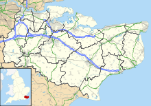
| Map | |||||||||||||||
 | |||||||||||||||
| Runways | |||||||||||||||
| |||||||||||||||
Gravesend Airport, located 2.5 miles (4.0 km) southeast of Gravesend town centre, Kent and 7.0 miles (11.3 km) west of Rochester. It was operated from 1932 until 1956.[1] It was initially a civil airfield, and became a Royal Air Force station known as RAF Gravesend during the Second World War, when it was under the control of RAF Fighter Command during the Battle of Britain. It was the first RAF station to operate the North American Mustang III. The airport returned to civilian use at the conclusion of the Second World War, although it remained under the ownership of the Air Ministry until its closure in 1956.
- ^ 609 at War. "Gravesend". Archived from the original on 23 July 2018. Retrieved 21 January 2013.
{{cite web}}: CS1 maint: numeric names: authors list (link)
