Gravvik Municipality
Gravvik herred | |
|---|---|
| Gravik herred (historic name) | |
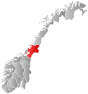
 Nord-Trøndelag within Norway | |
 Gravvik within Nord-Trøndelag | |
| Coordinates: 64°59′24″N 11°46′07″E / 64.99000°N 11.76861°E | |
| Country | Norway |
| County | Nord-Trøndelag |
| District | Namdalen |
| Established | 1 Jan 1909 |
| • Preceded by | Leka Municipality |
| Disestablished | 1 Jan 1964 |
| • Succeeded by | Nærøy Municipality |
| Administrative centre | Gravvika |
| Government | |
| • Mayor (1960–1963) | Edvin Aspli (Sp) |
| Area (upon dissolution) | |
| • Total | 191.6 km2 (74.0 sq mi) |
| • Rank | #380 in Norway |
| Highest elevation | 591 m (1,939 ft) |
| Population (1963) | |
| • Total | 804 |
| • Rank | #645 in Norway |
| • Density | 4.2/km2 (11/sq mi) |
| • Change (10 years) | |
| Official language | |
| • Norwegian form | Neutral[2] |
| Time zone | UTC+01:00 (CET) |
| • Summer (DST) | UTC+02:00 (CEST) |
| ISO 3166 code | NO-1754[4] |
Gravvik is a former municipality in the old Nord-Trøndelag county, Norway. The 192-square-kilometre (74 sq mi) municipality existed from 1909 until its dissolution in 1964. The municipality covered the northern coastal areas of the present-day Nærøysund Municipality in Trøndelag county. The administrative centre of the municipality was the village of Gravvika where the Gravvik Church is located.[5]
Prior to its dissolution in 1964, the 192-square-kilometre (74 sq mi) municipality was the 380th largest by area out of the 689 municipalities in Norway. Gravvik Municipality was the 645th most populous municipality in Norway with a population of about 804. The municipality's population density was 4.2 inhabitants per square kilometre (11/sq mi) and its population had decreased by 9.6% over the previous 10-year period.[6][7]
- ^ "Kart over Norge" (in Norwegian). Kartverket. 9 November 2024.
- ^ "Norsk Lovtidende. 2den Afdeling. 1932. Samling af Love, Resolutioner m.m". Norsk Lovtidend (in Norwegian). Oslo, Norway: Grøndahl og Søns Boktrykkeri: 453–471. 1932.
- ^ "Forskrift om målvedtak i kommunar og fylkeskommunar" (in Norwegian). Lovdata.no.
- ^ Bolstad, Erik; Thorsnæs, Geir, eds. (26 January 2023). "Kommunenummer". Store norske leksikon (in Norwegian). Kunnskapsforlaget.
- ^ Thorsnæs, Geir, ed. (8 December 2017). "Gravvik". Store norske leksikon (in Norwegian). Kunnskapsforlaget. Retrieved 29 April 2018.
- ^ Statistisk sentralbyrå. "Table: 06913: Population 1 January and population changes during the calendar year (M)" (in Norwegian).
- ^ Statistisk sentralbyrå (1 January 1951). Norges Sivile, Geistlige, Rettslige og Militære Inndeling 1. Januar 1951 (PDF). Norges Offisielle Statistikk (in Norwegian). Oslo, Norge: H. Aschehoug & Co.