Grayson County | |
|---|---|
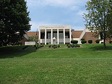
 Present-day Grayson County Courthouse | |
 Location within the U.S. state of Virginia | |
 Virginia's location within the U.S. | |
| Coordinates: 36°39′N 81°14′W / 36.65°N 81.23°W | |
| Country | |
| State | |
| Founded | 1793 |
| Named for | William Grayson |
| Seat | Independence |
| Largest town | Independence |
| Area | |
• Total | 446 sq mi (1,160 km2) |
| • Land | 442 sq mi (1,140 km2) |
| • Water | 3.8 sq mi (10 km2) 0.8% |
| Population (2020) | |
• Total | 15,333 |
| • Density | 34/sq mi (13/km2) |
| Time zone | UTC−5 (Eastern) |
| • Summer (DST) | UTC−4 (EDT) |
| Congressional district | 9th |
| Website | www |
Grayson County is a county located in the southwestern part of the Commonwealth of Virginia. As of the 2020 census, the population was 15,333.[1] Its county seat is Independence.[2] Mount Rogers, the state's highest peak at 5,729 feet (1,746 m), is in Grayson County.
- ^ "Grayson County, Virginia". United States Census Bureau. Retrieved January 30, 2022.
- ^ "Find a County". National Association of Counties. Archived from the original on May 31, 2011. Retrieved June 7, 2011.
