Greene County | |
|---|---|
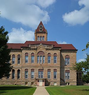
 Greene County Courthouse | |
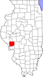
 Location within the U.S. state of Illinois | |
 Illinois's location within the U.S. | |
| Coordinates: 39°21′N 90°23′W / 39.35°N 90.39°W | |
| Country | |
| State | |
| Founded | 1821 |
| Named for | Nathanael Greene |
| Seat | Carrollton |
| Largest city | Carrollton |
| Area | |
| • Total | 546 sq mi (1,410 km2) |
| • Land | 543 sq mi (1,410 km2) |
| • Water | 3.3 sq mi (9 km2) 0.6% |
| Population (2020) | |
| • Total | 11,843 |
| • Density | 22/sq mi (8.4/km2) |
| Time zone | UTC−6 (Central) |
| • Summer (DST) | UTC−5 (CDT) |
| Congressional district | 15th |
| Website | https:// |
Greene County is a county located in the U.S. state of Illinois. According to the 2020 United States Census, it has a population of 11,843.[1] Its county seat is Carrollton.[2]
A notable archaeological area, the Koster Site, has produced evidence of more than 7,000 years of human habitation. Artifacts from the site are displayed at the Center for American Archeology in Kampsville, Illinois.
- ^ "U.S. Census Bureau QuickFacts: Greene County, Illinois".
- ^ "Find a County". National Association of Counties. Archived from the original on May 31, 2011. Retrieved June 7, 2011.