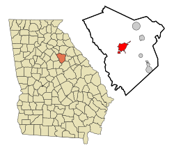
Greensboro, Georgia | |
|---|---|
City | |
 Greene County Courthouse in Greensboro | |
 Location in Greene County and the state of Georgia | |
| Coordinates: 33°34′18″N 83°10′51″W / 33.57167°N 83.18083°W | |
| Country | United States |
| State | Georgia |
| County | Greene |
| Area | |
| • Total | 6.97 sq mi (18.06 km2) |
| • Land | 6.91 sq mi (17.89 km2) |
| • Water | 0.07 sq mi (0.17 km2) |
| Elevation | 640 ft (195 m) |
| Population (2020) | |
| • Total | 3,648 |
| • Density | 528.16/sq mi (203.91/km2) |
| Time zone | UTC-5 (Eastern (EST)) |
| • Summer (DST) | UTC-4 (EDT) |
| ZIP code | 30642 |
| Area code | Area code 706 |
| FIPS code | 13-34876[2] |
| GNIS feature ID | 0356104[3] |
| Website | www |
Greensboro is a city in and the county seat of Greene County, Georgia, United States. Its population was 3,648 as of the 2020 census. The city is located approximately halfway between Atlanta and Augusta on Interstate 20.
- ^ "2020 U.S. Gazetteer Files". United States Census Bureau. Retrieved December 18, 2021.
- ^ "U.S. Census website". United States Census Bureau. Retrieved 2008-01-31.
- ^ "US Board on Geographic Names". United States Geological Survey. 2007-10-25. Retrieved 2008-01-31.