| Greers Ferry Dam | |
|---|---|
 Greers Ferry Dam in Cleburne County, Arkansas | |
| Country | United States |
| Location | Cleburne County, Arkansas |
| Coordinates | 35°31′15″N 91°59′36″W / 35.52083°N 91.99333°W |
| Status | Operational |
| Construction began | 1959 |
| Opening date | 1962 |
| Construction cost | $46.5 million |
| Dam and spillways | |
| Impounds | Little Red River |
| Height | 243 feet (74 m) |
| Length | 1,704 feet (519 m) |
| Reservoir | |
| Creates | Greers Ferry Lake |
| Total capacity | 2,844,000 acre⋅ft (3.508 km3) |
| Surface area | 31,500 acres (12,700 ha)[1] |
| Normal elevation | 462 feet (141 m) |
| Power Station | |
| Commission date | 1964 |
| Type | Conventional |
| Turbines | 2 |
| Installed capacity | 96 megawatts (129,000 hp) |
| Annual generation | 189 gigawatt-hours (6.4×10¹¹ BTU)[2] |
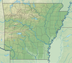
Greers Ferry Dam is located on the Little Red River in Cleburne County in the U.S. state of Arkansas. It impounds Greers Ferry Lake. The dam is located north of Little Rock.
- ^ "Greers Ferry Dam 50th Anniversary Dedication Celebration Ceremony" (PDF). United States Army Corps of Engineers. Retrieved February 2, 2019.
- ^ "Greers Ferry Dam, A project of the U.S. Army, Corps of Engineers" (PDF). Heber Springs Chamber of Commerce. October 3, 1963. p. 1. Retrieved August 2, 2011.
