| Groom Lake | |
|---|---|
 | |
| Location | Nevada, United States |
| Type | Dry lake |
| Basin countries | United States |
| Max. length | 3.7 miles (6.0 km) |
| Max. width | 3 miles (4.8 km) |
| Shore length1 | 11.3 miles (18.2 km) |
| Surface elevation | 4,409 ft (1,344 m) |
| 1 Shore length is not a well-defined measure. | |
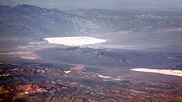
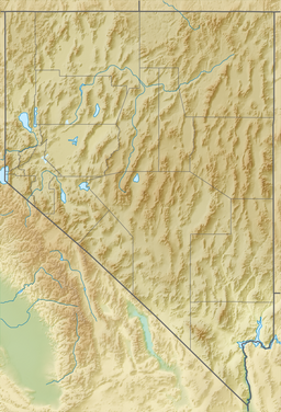
Groom Lake is a dry lake,[1] also described as a salt flat,[2] in Nevada. It is used for runways of the Nellis Bombing Range Test Site airport (KXTA).[3] Part of the Area 51 USAF installation, it lies at an elevation of 4,409 ft (1,344 m)[4] and is approximately 3.7 miles (6.0 km) from north to south and 3 miles (4.8 km) from east to west at its widest point, and is approximately 11.3 miles in circumference.[5] Located within the namesake Groom Lake Valley portion of the Tonopah Basin, the lake is 25 mi (40 km) south of Rachel, Nevada.[5]
The nearest publicly accessible vantage point is Tikaboo Peak, 26 miles to the east. There were two closer vantage points, dubbed "Freedom Ridge" and "White Sides", but they were closed to public access in 1995 to prevent people from taking pictures of the installation.[6]
- ^ Annie Jacobsen (May 17, 2011). Area 51: An Uncensored History of America's Top Secret Military Base. Little, Brown. p. 7. ISBN 978-0-316-19385-6.
- ^ Leiby, Richard (August 16, 2013). "Government officially acknowledges existence of Area 51, but not the UFOs". Washington Post. Retrieved December 25, 2017.
- ^ Marsh, Alton K. (January 10, 2008). "Don't Ask, Don't Tell: Area 51 Gets Airport Identifier". AOPA. Maryland. Retrieved March 6, 2019.
Weinberger, Sharon (January 18, 2018). "Area 51's New Name: 'Homey Airport'". Wired. New York. Retrieved March 6, 2019. - ^ "Groom Lake (GNIS code 840824)". Geographic Names Information System. United States Geological Survey, United States Department of the Interior. Retrieved January 11, 2015.
- ^ a b DREAMLAND: Fifty Years of Secret Flight Testing in Nevada By Peter W. Merlin
- ^ "Freedom Ridge and Roadblock Canyon". Dreamland Resort.
