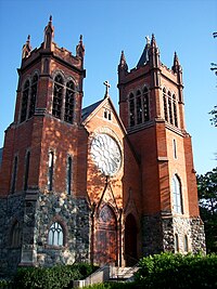
Grosse Pointe | |
|---|---|
 Cities that are included as part of the Grosse Pointe area within Wayne County (bottom) and Macomb County (top) | |
| Coordinates: 42°23′48″N 82°54′23″W / 42.39667°N 82.90639°W | |
| Country | United States |
| State | Michigan |
| Counties | Macomb and Wayne |
| Cities | Grosse Pointe Grosse Pointe Farms Grosse Pointe Park Grosse Pointe Shores Grosse Pointe Woods |
| Area | |
| • Total | 40.78 sq mi (105.6 km2) |
| • Land | 10.38 sq mi (26.9 km2) |
| • Water | 30.40 sq mi (78.7 km2) |
| Population | |
| • Total | 45,598 |
| • Density | 4,392.9/sq mi (1,696.1/km2) |
| Time zone | UTC-5 (EST) |
| • Summer (DST) | UTC-4 (EDT) |
| Zip code(s) | 48230, 48236 |
| Area code | 313 |

Grosse Pointe refers to an affluent coastal area next to Detroit, Michigan, United States, that comprises five adjacent individual cities. From southwest to northeast, they are:
- Grosse Pointe Park
- Grosse Pointe
- Grosse Pointe Farms
- Grosse Pointe Shores (incorporated in 2009 from the remnants of two townships: Grosse Pointe Township in Wayne County and Lake Township in Macomb County)
- Grosse Pointe Woods
The terms "Grosse Pointe" or "the Pointes" are ordinarily used to refer to the entire area, referencing all five individual communities, with a total population of about 46,000. The Grosse Pointes altogether are 10.4 square miles, bordered by Detroit on the south and west, Lake St. Clair on the east and south, Harper Woods on the west of some portions, and St. Clair Shores on the north. The cities are in eastern Wayne County, except for a very small section in Macomb County. The Pointes begin six miles (10 km) northeast of downtown Detroit and extend several miles northeastward, in a narrow swath of land, to the edge of Wayne County. The name "Grosse Pointe" derives from the size of the area, and its projection into Lake St. Clair.[2]
Grosse Pointe is a suburban area in Metro Detroit, sharing a border with northeast Detroit's historic neighborhoods. Grosse Pointe has many famous historic estates along with remodeled homes and newer construction. Downtown Grosse Pointe, along Kercheval Avenue from Neff to Cadieux, nicknamed "The Village," serves as a central business district for all five of the Grosse Pointes, although each of them (except Grosse Pointe Shores) has several blocks of retail. Downtown Detroit is just over seven miles (11 km) west of this downtown area, accessed by Jefferson Avenue, or several other cross-streets.
The north–south area along Lake St. Clair generally coincides with the boundaries of the two public high schools. The southern areas (basically south and west of Moross Road) feature retail districts.
- ^ a b "Michigan: 2010 Population and Housing Unit Counts 2010 Census of Population and Housing" (PDF). 2010 United States Census. United States Census Bureau. September 2012. pp. 31, 44–45 Michigan. Retrieved May 1, 2020.
- ^ Farmer, Silas (1890). History of Detroit and Wayne County and Early Michigan, p. 129. Munsell & Co.
