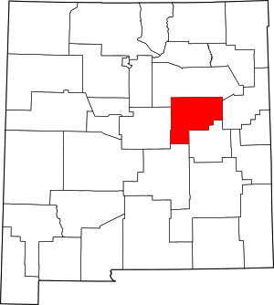
Guadalupe County | |
|---|---|
 Guadalupe County Courthouse in Santa Rosa | |
 Location within the U.S. state of New Mexico | |
 New Mexico's location within the U.S. | |
| Coordinates: 34°52′N 104°47′W / 34.86°N 104.78°W | |
| Country | |
| State | |
| Founded | February 26, 1891 |
| Named for | Our Lady of Guadalupe |
| Seat | Santa Rosa |
| Largest city | Santa Rosa |
| Area | |
| • Total | 3,032 sq mi (7,850 km2) |
| • Land | 3,030 sq mi (7,800 km2) |
| • Water | 1.1 sq mi (3 km2) 0.04% |
| Population (2020) | |
| • Total | 4,452 |
| • Density | 1.5/sq mi (0.57/km2) |
| Time zone | UTC−7 (Mountain) |
| • Summer (DST) | UTC−6 (MDT) |
| Congressional district | 2nd |

Guadalupe County (Spanish: Condado de Guadalupe) is a county in the U.S. state of New Mexico. As of the 2020 census, the population was 4,452.[1] Its county seat is Santa Rosa.[2]
- ^ "Guadalupe County, New Mexico". United States Census Bureau. Retrieved July 3, 2023.
- ^ "Find a County". National Association of Counties. Archived from the original on May 31, 2011. Retrieved June 7, 2011.