| Guadalupe Group | |
|---|---|
| Stratigraphic range: Campanian-Maastrichtian ~ | |
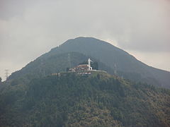
 Guadalupe Hill Type locality of the Guadalupe Group | |
| Type | Geological group |
| Sub-units | Arenisca Labor-Tierna Plaeners Arenisca Dura |
| Underlies | Guaduas Formation |
| Overlies | Villeta Group Conejo Fm. & Chipaque Fm. |
| Lithology | |
| Primary | Sandstone, shale |
| Other | Salt (allochthonous) |
| Location | |
| Coordinates | 4°35′31″N 74°03′15″W / 4.59194°N 74.05417°W |
| Region | Altiplano Cundiboyacense Eastern Ranges, Andes |
| Country | |
| Type section | |
| Named for | Guadalupe Hill |
| Named by | Pérez & Salazar |
| Year defined | 1978 |
| Coordinates | 4°35′31″N 74°03′15″W / 4.59194°N 74.05417°W |
| Region | Cundinamarca, Boyacá |
| Country | |
| Thickness at type section | 750 metres (2,460 ft) |
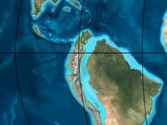
 Paleogeography of Northern South America 65 Ma, by Ron Blakey | |
The Guadalupe Group (Spanish: Grupo Guadalupe, K2G, Ksg) is a geological group of the Altiplano Cundiboyacense, Eastern Ranges of the Colombian Andes. The group, a sequence of shales and sandstones, is subdivided into three formations; Arenisca Dura, Plaeners and Arenisca Labor-Tierna, and dates to the Late Cretaceous period; Campanian-Maastrichtian epochs and at its type section has a thickness of 750 metres (2,460 ft).