| Guadalupe River | |
|---|---|
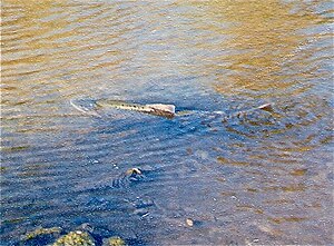
 Chinook salmon spawning on the Los Gatos Creek tributary of Guadalupe River by California Highway 17 in 1996 | |
| Etymology | Spanish language |
| Native name | Thámien Rúmmey (Northern Ohlone) |
| Location | |
| Country | United States |
| State | California |
| Region | Santa Clara County |
| City | San Jose, California |
| Physical characteristics | |
| Source | Lake Almaden, at confluence of Los Alamitos Creek and Guadalupe Creek |
| • location | San Jose, California |
| • coordinates | 37°14′48″N 121°52′16″W / 37.24667°N 121.87111°W[1] |
| • elevation | 194 ft (59 m) |
| Mouth | Alviso Slough, San Francisco Bay |
• location | Alviso, San Jose, California |
• coordinates | 37°25′33″N 121°58′46″W / 37.42583°N 121.97944°W[1] |
• elevation | 0 ft (0 m) |
| Basin features | |
| Tributaries | |
| • left | Guadalupe Creek, Ross Creek, Los Gatos Creek |
| • right | Los Alamitos Creek, Canoas Creek |
The Guadalupe River (Spanish: Río Guadalupe; Muwekma Ohlone:Thámien Rúmmey) mainstem is an urban, northward flowing 14 miles (23 km) river in California whose much longer headwater creeks originate in the Santa Cruz Mountains. The river mainstem now begins on the Santa Clara Valley floor when Los Alamitos Creek exits Lake Almaden and joins Guadalupe Creek just downstream of Coleman Road in San Jose, California. From here it flows north through San Jose, where it receives Los Gatos Creek, a major tributary. The Guadalupe River serves as the eastern boundary of the City of Santa Clara and the western boundary of Alviso, and after coursing through San José, it empties into south San Francisco Bay at the Alviso Slough.
Much of the river is surrounded by parks. The river's Los Alamitos and Guadalupe Creek tributaries are, in turn, fed by smaller streams flowing from Almaden Quicksilver County Park, home to former mercury mines dating back to when the area was governed by Mexico. The Guadalupe watershed carries precipitation from the slopes of Loma Prieta and Mount Umunhum, the two major peaks of the Sierra Azul, the historical Spanish name ("Blue Mountains") for that half of the Santa Cruz Mountains south of California Highway 17.[3][4] Two of the Guadalupe River's major tributaries, Los Gatos Creek and Guadalupe Creek have their sources in the Sierra Azul Open Space Preserve on the western and eastern flanks of the Sierra Azul.
- ^ a b c U.S. Geological Survey Geographic Names Information System: Guadalupe River
- ^ Durham, David L. (1998). Durham's Place Names of California's San Francisco Bay Area: Includes Marin, San Francisco, San Mateo, Contra Costa, Alameda, Solano & Santa Clara counties. Word Dancer Press, Sanger, California. p. 639. ISBN 978-1-884995-35-4.
- ^ Thomas, John Hunter (1991). Flora of the Santa Cruz Mountains of California: A Manual of the Vascular Plants. Stanford University Press. p. 5. ISBN 978-0-8047-1862-2. Retrieved 2014-07-27.
- ^ Ingersoll, Luther A. (1893). Henry D. Barrows (ed.). A memorial and biographical history of the coast counties of Central California. Lewis Publishing Company. p. 190. Retrieved 2014-07-27.
