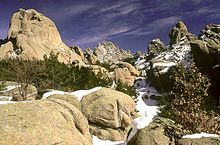
| Sierra de Guadarrama National Park | |
|---|---|
 Peñalara Peak and Peñalara glacial lagoon | |
 Location of Guadarrama | |
| Location | Sierra de Guadarrama (Castile and León and Community of Madrid, Spain) |
| Coordinates | 40°47′N 3°59′W / 40.783°N 3.983°W |
| Area | 339.60 km2 |
| Established | June 26, 2013 |
| Governing body | Spanish Ministry of Environment. |


Sierra de Guadarrama National Park (in Spanish: Parque Nacional de la Sierra de Guadarrama) is a national park in Spain, covering nearly 34,000 hectares, the fifth largest in Spain's national parks system. The Guadarrama mountain range (Sistema Central) contains some ecologically valuable areas, located in the Community of Madrid and Castile and León (provinces of Segovia and Ávila). The law that regulates the recently approved national park was published in the BOE in June 26, 2013.[1]
- ^ (in Spanish) Boletín Oficial del Estado (2013-06-26). LEY 7/2013, de 25 de junio, de declaración del Parque Nacional de la Sierra de Guadarrama (PDF) (Report). Gobierno de España. Retrieved 2013-06-27.