This article needs additional citations for verification. (July 2008) |
Santiago de Gualaceo | |
|---|---|
 Gualaceo's Main Church | |
| Motto: Justo Y Fuerte | |
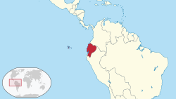
 Location Ecuador | |
 Location Gualaceo | |
| Coordinates: 2°54′0″S 78°47′0″W / 2.90000°S 78.78333°W | |
| Country | Ecuador |
| Province | Azuay |
| Parishes | Gualaceo San Juan Mariano Moreno Remigio Crespo Luis Cordero Jadan Zhidmad |
| Settled | 1534 |
| Canton | June 25, 1824 |
| Government | |
| • Mayor | Marco Tapia |
| Area | |
| • Total | 345.9 km2 (133.6 sq mi) |
| Elevation | 2,449 m (8,032 ft) |
| Population (2022 census)[1] | |
| • Total | 43,188 |
| • Density | 120/km2 (320/sq mi) |
| Time zone | UTC-5 (GMT-5:00 (Quito, Bogota, Lima)) |
| Website | www.gualaceo.gob.ec |
Gualaceo Canton, nicknamed “El Jardin del Azuay” (The Garden of Azuay), is a canton in the sierra region of Ecuador in the Azuay Province. The seat of the canton Gualaceo, is located 35 km east from the city of Cuenca and is one of the biggest cities in Azuay.
Gualaceo Canton has a population of 43,188. It is crossed by the three rivers Santa Bárbara, San Francisco and Guaymincay, and carries the nickname “El Jardin del Azuay” due to the natural surroundings and mountains. The city of Gualaceo currently holds the title of Cultural Heritage Site of the Nation. Gualaceo became an independent canton on the 25 June 1824.
- ^ Citypopulation.de Population and area of Gualaceo Canton

