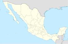
Guerrero Negro Airport Aeropuerto de Guerrero Negro | |||||||||||
|---|---|---|---|---|---|---|---|---|---|---|---|
| Summary | |||||||||||
| Airport type | Public | ||||||||||
| Operator | Exportadora de Sal S.A. | ||||||||||
| Serves | Guerrero Negro, Baja California Sur, Mexico | ||||||||||
| Location | San Quintín Municipality, Baja California, Mexico | ||||||||||
| Time zone | PST (UTC-08:00) | ||||||||||
| • Summer (DST) | PDT (UTC-07:00) | ||||||||||
| Elevation AMSL | 18 m / 59 ft | ||||||||||
| Coordinates | 28°01′33″N 114°01′26″W / 28.02583°N 114.02389°W | ||||||||||
| Map | |||||||||||
 | |||||||||||
| Runways | |||||||||||
| |||||||||||
| Statistics (2021) | |||||||||||
| |||||||||||
Source: Agencia Federal de Aviación Civil | |||||||||||
Guerrero Negro Airport (Spanish: Aeropuerto de Guerrero Negro) (IATA: GUB, ICAO: MMGR) is an airport situated in the municipality of San Quintín, Baja California, Mexico. The facility serves regional flights and supports general aviation activities in Guerrero Negro, Baja California Sur, Mexico.
Operated by Exportadora de Sal S.A., the largest company in the region, the airport is located at an elevation of 18 metres (59 ft) above mean sea level. The airport features a single asphalt runway, designated as 12/30, with a length of 2,200 metres (7,200 ft). Additional infrastructure includes an apron, hangars, and a small terminal building.
Air Force Station No. 2 (Spanish: Estación Aérea Militar N.º 2 Guerrero Negro) (E.A.M. No. 2) is situated on the airport grounds. This station does not currently have active squadrons assigned to it. It includes a small apron, one hangar, and other facilities designed to accommodate Air Force personnel.[1]

