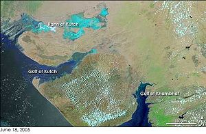

The Gulf of Kutch is located between the peninsula regions of Kutch and Saurashtra, bounded in the state of Gujarat that borders Pakistan. It opens towards the Arabian Sea facing the Gulf of Oman.
It is about 50 km wide at the entrance before narrowing into marshland, creeks and inlets.[1] The south coast is bordered by islands, mud flats and coral reefs, due to the large amount of marine life found in this region it has large sections of it have become protected as parks and sanctuaries. The northern side is lined with extensive mud flats, the largest of which lie between Mundra and Kuvay. Also, a large portion of the shipping harbours in the region are located on the northern side including Māndvi, Bedi, and Kandla. Maximum depth of the Gulf of Kutch is around 123m (403 ft).[1] Additionally, there are numerous shoals at the mouth of the gulf namely Lushington, Ranwara, Bobby and Gurur. The gulf expands deep into Gujarat with a length of approximately 150 km before becoming an 8500 km^2 delta. The low annual rainfall that flows into the gulf means that there are no major rivers going into the gulf and creating run-off.[2]
Tidal conditions range with spring tide peaking around 6.2 m while the annual average is around 4 m. Moreover, the height of the tides can also vary depending on how deep into the gulf it's recorded. Ohka has been measured in a range of 3.06 m while Kandla has shown heights of 5.89 m at the same time.[1] Similarly, the speed of the current has been recorded between 1.5 to 2.5 knots at the entrance and 3 to 5 knots within the centre.[2]
- ^ a b c Wagle, B G (1979). "Geomorphology of the Gulf of Kutch" (PDF). Indian Journal of Marine Sciences. 8: 123–126.
- ^ a b Kunte, P. D.; Wagle, B. G.; Sugimori, Yasuhiro (January 2003). "Sediment transport and depth variation study of the Gulf of Kutch using remote sensing". International Journal of Remote Sensing. 24 (11): 2253–2263. doi:10.1080/01431160210164316. ISSN 0143-1161. S2CID 128498617.