| Hackney Marshes | |
|---|---|
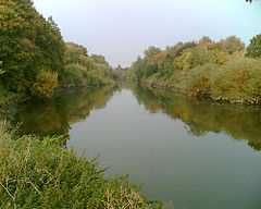
 The River Lea passing through Hackney Marshes | |
Location within Greater London | |
| OS grid reference | TQ375845 |
| • Charing Cross | 6 mi (9.7 km) SW |
| London borough | |
| Ceremonial county | Greater London |
| Region | |
| Country | England |
| Sovereign state | United Kingdom |
| Post town | LONDON |
| Postcode district | E9, E10 |
| Dialling code | 020 |
| Police | Metropolitan |
| Fire | London |
| Ambulance | London |
| UK Parliament | |
| London Assembly | |
Hackney Marshes is an area of open space in London's Lower Lea Valley, lying on the western bank of the River Lea. It takes its name from its position on the eastern boundary of Hackney, the principal part of the London Borough of Hackney, and from its origin as an area of true marsh.
The marshes were extensively drained from Medieval times onwards, and rubble was dumped here from buildings damaged by air raids during World War II, raising the level of the ground.
The principal area of the marsh lies below Lea Bridge Road between the Old River Lea, and the Hackney Cut – an artificial channel of the Lee Navigation, dug about 1770, to avoid a loop in the natural watercourse. The southern extent is marked by the A12; although the industrial land around Hackney Wick Stadium was originally an extension of the marsh, it now forms a part of the Olympic Park for the 2012 Summer Olympics.
Hackney Marsh is one of the largest areas of common land in Greater London, with 136.01 hectares (336.1 acres) of protected commons.[1]
- ^ "Common Land and the Commons Act 2006". Defra. 13 November 2012. Retrieved 3 February 2013.
