Hadsel Municipality
Hadsel kommune | |
|---|---|
 View of Stokmarknes during the winter | |
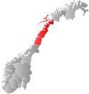
 Nordland within Norway | |
 Hadsel within Nordland | |
| Coordinates: 68°32′06″N 14°49′30″E / 68.53500°N 14.82500°E | |
| Country | Norway |
| County | Nordland |
| District | Vesterålen |
| Established | 1 Jan 1838 |
| • Created as | Formannskapsdistrikt |
| Administrative centre | Stokmarknes |
| Government | |
| • Mayor (2023) | Kjell-Børge Freiberg (H) |
| Area | |
| • Total | 566.61 km2 (218.77 sq mi) |
| • Land | 550.73 km2 (212.64 sq mi) |
| • Water | 15.88 km2 (6.13 sq mi) 2.8% |
| • Rank | #191 in Norway |
| Highest elevation | 1,135.85 m (3,726.54 ft) |
| Population (2024) | |
| • Total | 8,236 |
| • Rank | #130 in Norway |
| • Density | 14.5/km2 (38/sq mi) |
| • Change (10 years) | |
| Demonym | Hadselværing[2] |
| Official language | |
| • Norwegian form | Bokmål |
| Time zone | UTC+01:00 (CET) |
| • Summer (DST) | UTC+02:00 (CEST) |
| ISO 3166 code | NO-1866[4] |
| Website | Official website |
Hadsel (Northern Sami: Válafierda) is a municipality in Nordland county, Norway. It is part of the traditional district of Vesterålen. The administrative centre of the municipality is the town of Stokmarknes. Some of the main villages in Hadsel include Fiskebøl, Jarstad, Grønning, Grytting, Hanøyvika, Hennes, Kaldjorda, Melbu, Sanden, and Sandnes.


The municipality is the southernmost municipality in the Vesterålen region. It is spread over several main islands: Hadseløya, Børøya, Hinnøya, Langøya, and Austvågøya. About 70% of the population live on Hadseløya island. Hadseløya island is connected to Langøya by the Hadsel Bridge and Børøy Bridge. Also, the Stokmarknes Airport, Skagen, is located nearby. It is the busiest small aircraft airport in Norway, serving 100,000 passengers annually (1997).
The 567-square-kilometre (219 sq mi) municipality is the 191st largest by area out of the 357 municipalities in Norway. Hadsel is the 130th most populous municipality in Norway with a population of 8,236. The municipality's population density is 14.5 inhabitants per square kilometre (38/sq mi) and its population has increased by 1.5% over the previous 10-year period.[5][6]
- ^ "Høgaste fjelltopp i kvar kommune" (in Norwegian). Kartverket. 16 January 2024.
- ^ "Navn på steder og personer: Innbyggjarnamn" (in Norwegian). Språkrådet.
- ^ "Forskrift om målvedtak i kommunar og fylkeskommunar" (in Norwegian). Lovdata.no.
- ^ Bolstad, Erik; Thorsnæs, Geir, eds. (26 January 2023). "Kommunenummer". Store norske leksikon (in Norwegian). Kunnskapsforlaget.
- ^ Statistisk sentralbyrå. "Table: 06913: Population 1 January and population changes during the calendar year (M)" (in Norwegian).
- ^ Statistisk sentralbyrå. "09280: Area of land and fresh water (km²) (M)" (in Norwegian).

