Hagere Selam
ሃገረ ሰላም May Aleqti, Idaga Hamus | |
|---|---|
Town | |
 | |
| Coordinates: 13°39′N 39°10′E / 13.650°N 39.167°E | |
| Country | |
| Region | |
| Zone | Maekelay (Central) |
| Woreda | Dogu'a Tembien |
| Area | |
| • Total | 5.22 km2 (2.02 sq mi) |
| Elevation | 2,625 m (8,612 ft) |
| Population (2007) | |
| • Total | 8,130 |
| • Density | 1,557/km2 (4,030/sq mi) |
| Time zone | UTC+3 (EAT) |

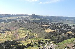
Hagere Selam (Tigrinya: ሃገረ ሰላም) is a town in northern Ethiopia. Located on the Mekelle-Abiy Addi regional road, it is located at an elevation of 2650 metres above sea level. The town is the administrative center of the Dogu'a Tembien woreda. The weekly market is on Saturdays.
Hagere Selam is located on the saddle point between two of the higher points in Tigray (Imba Zuw'ala and Tsatsen). The regional road from Mekelle to Abiy Addi climbs towards Hagere Selam, before going down to the Abergele lowlands. The area is categorized as highland or dega. The local economy is dependent on trading, agriculture, with barley being the main crop grown in the area, and on milk production and apiculture.

