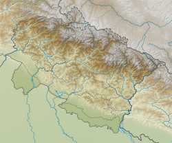
Haldwani | |
|---|---|
| Nickname(s): Green city, Gateway of Kumaon | |
| Coordinates: 29°13′N 79°31′E / 29.22°N 79.52°E | |
| Country | |
| State | Uttarakhand |
| Division | Kumaon |
| District | Nainital |
| Founded | 1834 |
| Municipality | 1942 |
| Founded by | George William Traill |
| Named for | Haldu |
| Government | |
| • Type | Mayor–Council |
| • Body | Haldwani Municipal Corporation |
| • Mayor | Vacant |
| • Municipal Commissioner | Vandana Singh, IAS |
| Area | |
| • Total | 250 km2 (100 sq mi) |
| Elevation | 424 m (1,391 ft) |
| Population | |
| • Total | 656,000 |
| • Density | 2,600/km2 (6,800/sq mi) |
| Languages | |
| • Official | Hindi |
| • Native | Kumaoni |
| Time zone | UTC+5:30 (IST) |
| PIN | 263139,263141 |
| Telephone code | +91-5946 |
| Vehicle registration | UK-04 |
| Website | nagarnigamhaldwani |
Haldwani (Kumaoni: Haldvānī) is the largest city of Kumaon. It is also the third most populous city in the Indian state of Uttarakhand. Haldwani is said to be the financial capital of Uttarakhand, having the most commercial, economic and industrial activities of the state. Haldwani is located in the Nainital District, and is one of its eight Subdivisions. The Haldwani Urban agglomeration has 656,000 people as of 2021, and is the third most populous UA in Uttarakhand, after Dehradun and Haridwar. Being situated in the immediate foothills of Kumaon Himalayas, the Kathgodam neighbourhood of Haldwani is known as the "Gateway to Kumaon".
Located in the Bhabhar region in the Himalayan foothills on the banks of the Gaula River, the town of Haldwani was established in 1834, as a mart for hill people who visited Bhabar during the cold season. The establishment of the Bareilly–Nainital provincial road in 1882 and the Bhojeepura–Kathgodam railway line by Rohilkund and Kumaon Railway in 1884 helped develop the town into a major trading post and then a hub between the hilly regions of Kumaon and the Indo-Gangetic Plains.
- ^ Cite error: The named reference
dchbawas invoked but never defined (see the help page). - ^ "Haldwani and Kathgodam Town Population Census 2019 | Uttarakhand". www.census2011.co.in. Retrieved 4 July 2017.


