Haltdalen Municipality
Haltdalen herred | |
|---|---|
| Holtaalen herred (historic name) | |
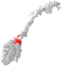
 Sør-Trøndelag within Norway | |
 Haltdalen within Sør-Trøndelag | |
| Coordinates: 62°55′36″N 11°08′26″E / 62.9266°N 11.1406°E | |
| Country | Norway |
| County | Sør-Trøndelag |
| District | Gauldalen |
| Established | 1 Jan 1838 |
| • Created as | Formannskapsdistrikt |
| Disestablished | 1 Jan 1972 |
| • Succeeded by | Holtålen Municipality |
| Administrative centre | Haltdalen |
| Area (upon dissolution) | |
| • Total | 509 km2 (197 sq mi) |
| Population (1972) | |
| • Total | 778 |
| • Density | 1.5/km2 (4.0/sq mi) |
| Demonyms | Haltdaling Haltdøl[1] |
| Time zone | UTC+01:00 (CET) |
| • Summer (DST) | UTC+02:00 (CEST) |
| ISO 3166 code | NO-1645[2] |
Haltdalen (historically: Holtaalen) is a former municipality in the old Sør-Trøndelag county, Norway. The 509-square-kilometre (197 sq mi) municipality existed from 1838 until 1972 when it was merged with Ålen to become the present-day municipality of Holtålen in Trøndelag county. The administrative centre of the municipality was the village of Haltdalen where the Haltdalen Church is located.[3]
- ^ "Navn på steder og personer: Innbyggjarnamn" (in Norwegian). Språkrådet.
- ^ Bolstad, Erik; Thorsnæs, Geir, eds. (26 January 2023). "Kommunenummer". Store norske leksikon (in Norwegian). Kunnskapsforlaget.
- ^ Thorsnæs, Geir, ed. (21 December 2017). "Haltdalen – tidligere kommune". Store norske leksikon (in Norwegian). Kunnskapsforlaget. Retrieved 17 January 2018.