| Ham | |
|---|---|
 | |
 Housing by Ham Parade | |
Location within Greater London | |
| Area | 9.26 km2 (3.58 sq mi) |
| Population | 10,317 (Ham Petersham and Richmond Riverside wards 2011)[1] |
| • Density | 1,114/km2 (2,890/sq mi) |
| OS grid reference | TQ1813673150 |
| London borough | |
| Ceremonial county | Greater London |
| Region | |
| Country | England |
| Sovereign state | United Kingdom |
| Post town | RICHMOND |
| Postcode district | TW10 |
| Dialling code | 020 |
| Police | Metropolitan |
| Fire | London |
| Ambulance | London |
| UK Parliament | |
| London Assembly | |
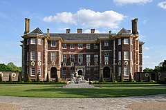
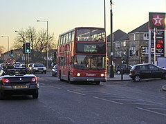
Ham is a suburban[2] district in Richmond, south-west London. It has meadows adjoining the River Thames where the Thames Path National Trail also runs. Most of Ham is in the London Borough of Richmond upon Thames and, chiefly, within the ward of Ham, Petersham and Richmond Riverside; the rest is in the Royal Borough of Kingston upon Thames. The district has modest convenience shops and amenities, including a petrol station and several pubs, but its commerce is subsidiary to the nearby regional-level economic centre of Kingston upon Thames.
- ^ "Key Statistics; Quick Statistics: Population Density". Office for National Statistics. Archived from the original on 11 February 2003. Retrieved 22 December 2013.
- ^ A City of Villages: Promoting a sustainable future for London's suburbs (PDF). SDS Technical Report 11. Greater London Authority. August 2002. ISBN 1-85261-393-9. Archived from the original (PDF) on 27 September 2013. Retrieved 16 January 2014.
